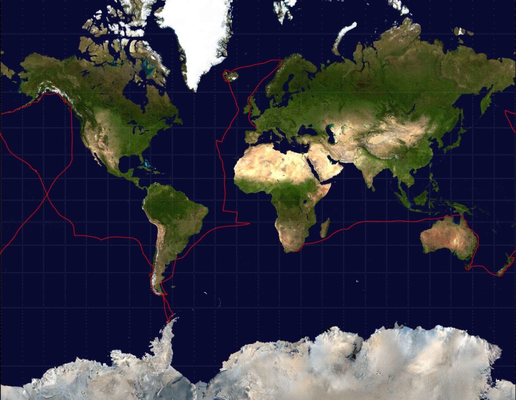
 The route of the 9-metre sloop Yarra. The Yarra travelled about 55000 nautical miles in a single 7-year trip, covering all latitudes between the Arctic and the Antarctic and making landfall on every continent. |
 Wooden barrels on the beach in Whaler’s Bay, Deception Island (62°58′ S, 60°39′ W) in the South Shetland Islands. |
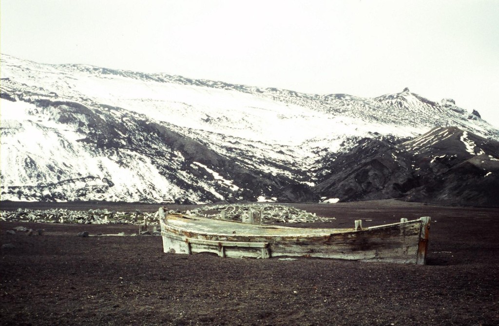 A decked dory from the whaling days abandoned on the beach at Deception Island, South Shetland Islands. The heat from the volcanism keeps all the low ground free of the ice and snow that otherwise cover all lands year-round at this latitude. |
 Reflections in the icy waters of Paradise Bay, Antarctic Peninsula. |
 Floating ice in Paradise Bay, Antarctic Peninsula. I expected this to be fresh water ice, calved from the glaciers surrounding the bay. After throwing small pieces into my water tank to replenish my reserves, I later discovered that occasional tiny little shrimp-like creatures were coming through the faucet when pumping water. Older sea ice loses its salinity over time. |
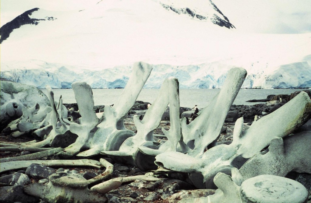 Whale skeleton at Port Lockroy, Wiencke Island, Antarctica. The bones were huge and the vertebra in the lower right quadrant high enough to be used as a seat. |
 The sloop Yarra sheltered behind a string of reefs at Dorian Bay, Wiencke Island, Antarctic Peninsula. |
 The sloop Yarra anchored behind the shoals at Dorian Bay, Wiencke Island, Antarctic Peninsula. The shallow waters keep the ice out of the bay, an essential condition for Antarctic anchorages. A violent storm swept over the region while I was anchored there: no other option than weathering it out, as much chain as possible out, stern close to the rocks. |
 Gentoo penguins and chicks at Dorian Bay, Wiencke Island, Antarctic Peninsula. Operating with a simple 35mm lens, I was less than one metre away from the nearest birds to take this photo. |
 Barbara Channel is a complex and tortuous passage linking the northwest approach of the Beagle Channel to Magellan Strait at the bottom end of Chili. This photo was taken in early April as the austral winter was already setting in, just before the junction with Magellan Strait at the level of Islas Charles. |
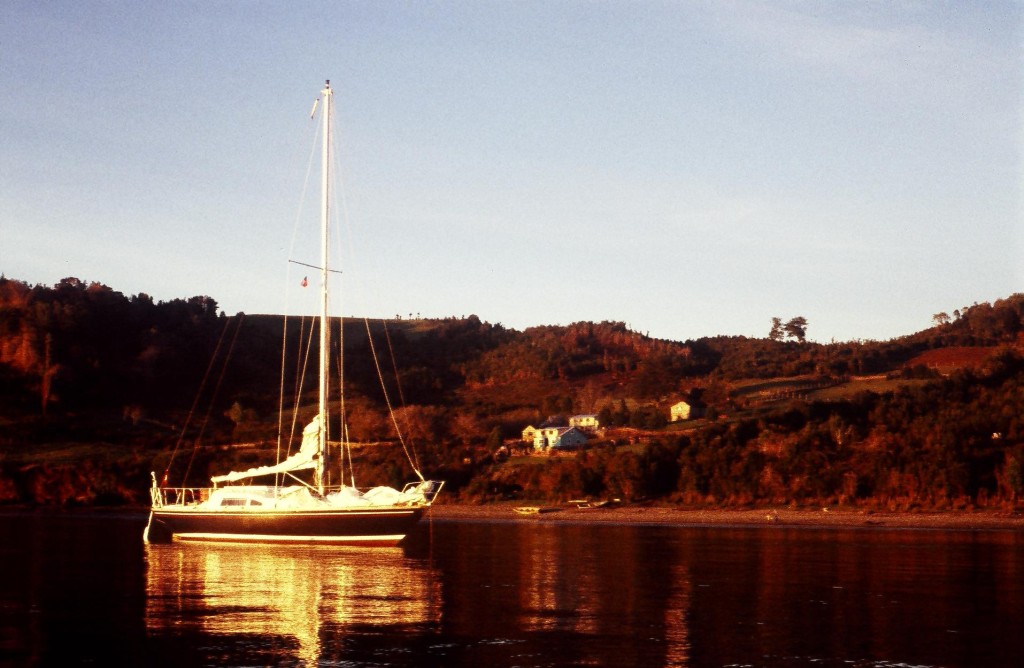 Yarra at Puerto San Pedro, Chiloé, Chili. First sunset in weeks after sailing up the Patagonian Channels. |
 Rock carvings and view over the motus (islets) from the site of Orongo at Easter Island. Located at the edge of a cliff near the highest point of the Rano Kau volcano, Orongo was the location of the man-bird ceremonies, which were taking place in the cold of the austral winter. |
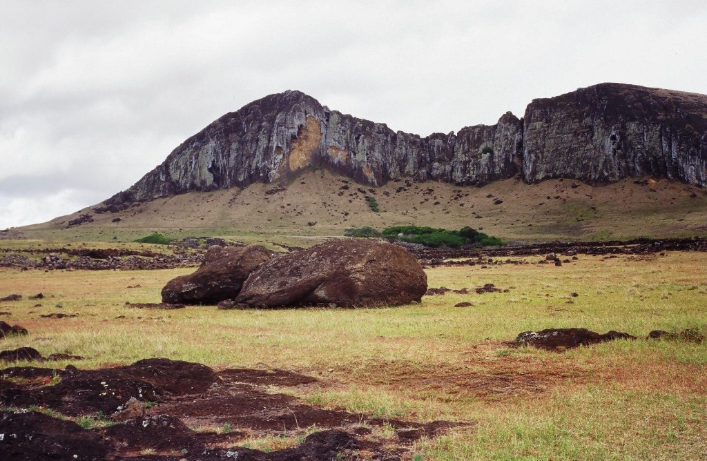 The eroded ridge of the Rano-Raraku volcano where the statues of Easter Island were carved out of the rock. |
 The crater of the Rano-Raraku volcano at Easter Island, seen from the summit of the ridge, contains a lake partly covered by floating islands of reeds. |
 The slopes of Mount Duff (441m) on Mangareva Island. The long grass further up was also home to very territorial yellow wasps. |
 Spectacular eroded rock formations at Hanavave Bay, Fatu-Hiva, Marquesas Islands. Fatu-Hiva is geologically the youngest of the islands in the group, with much more prominent features. |
 The sloop Yarra anchored in the remote and little known Aleutian Islands. Crater Bay is fringed by Khvostof, Davidof and Pyramid islands, the remains of a sunk volcano in the Rat Islands group.
Such visibility is the rarest of occurrences in the region in summer and one never goes ashore without a compass and serious bearings to find the boat again. Half-an-hour later, as I was coming back from the ridge, thick fog was rolling back in. |
 Volcanic ground at Arch Point along the Alaskan Peninsula on a gorgeous summer day. After discovering a tiny bay, just large enough to hold the sloop, an excursion ashore was not to be missed. |
 Reid Inlet in Glacier Bay National Park in southeast Alaska. Low tide at the foot of the calving glacier leaves ice pieces stranded like giant gemstones. With the summer well and truly gone, I had the entire area almost to myself.
Every six hours, blocks of ice bumped the hull on their way out, until the temperature on board climbed again considerably with the next incoming tide. |